Imagine Nicholasville Road Lexington, Kentucky
Services Provided
Urban Design
Planning
Transit Oriented Development
Transportation Planning
Corridor Planning
Engagement
People Involved
Andy Knight
Luis Calvo
Awards
2021 KYAPA Special Merit Award for Outstanding Corridor Plan
A comprehensive and transformative transit-oriented development plan for the revitalization of a key urban corridor
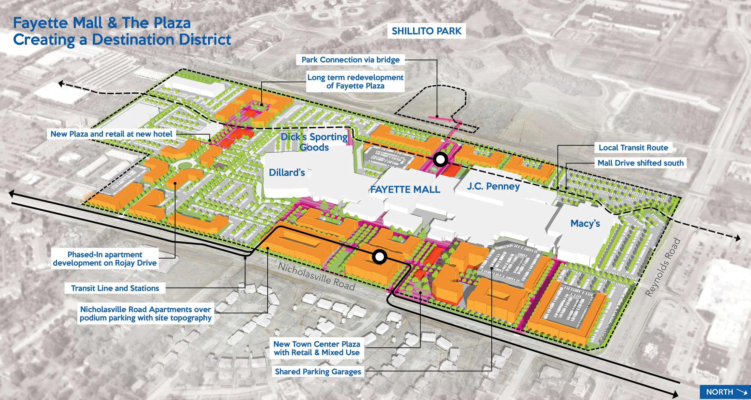
The final plan re-imagines Nicholasville Road as a premium transit corridor and includes concepts for three catalyst sites. The sites, which include an aging retail shopping center, a traditional suburban mall, and a research farm owned by the University of Kentucky, were selected using a methodology involving objective criteria and input from the community. The concepts illustrate how TOD can occur on Nicholasville Road as commercial properties redevelop, and how this can help address Lexington’s housing needs. The study’s proposed transportation improvements create a vision for how to create a more pedestrian and transit-oriented street, with the goal of improving and increasing public transit use to move people more efficiently along this important regional corridor.
Recommendations from this study will be used to guide future development efforts and decision-making for Nicholasville Road. The study will also be used to prioritize transportation investments and coordinate them with redevelopment as it occurs over time.
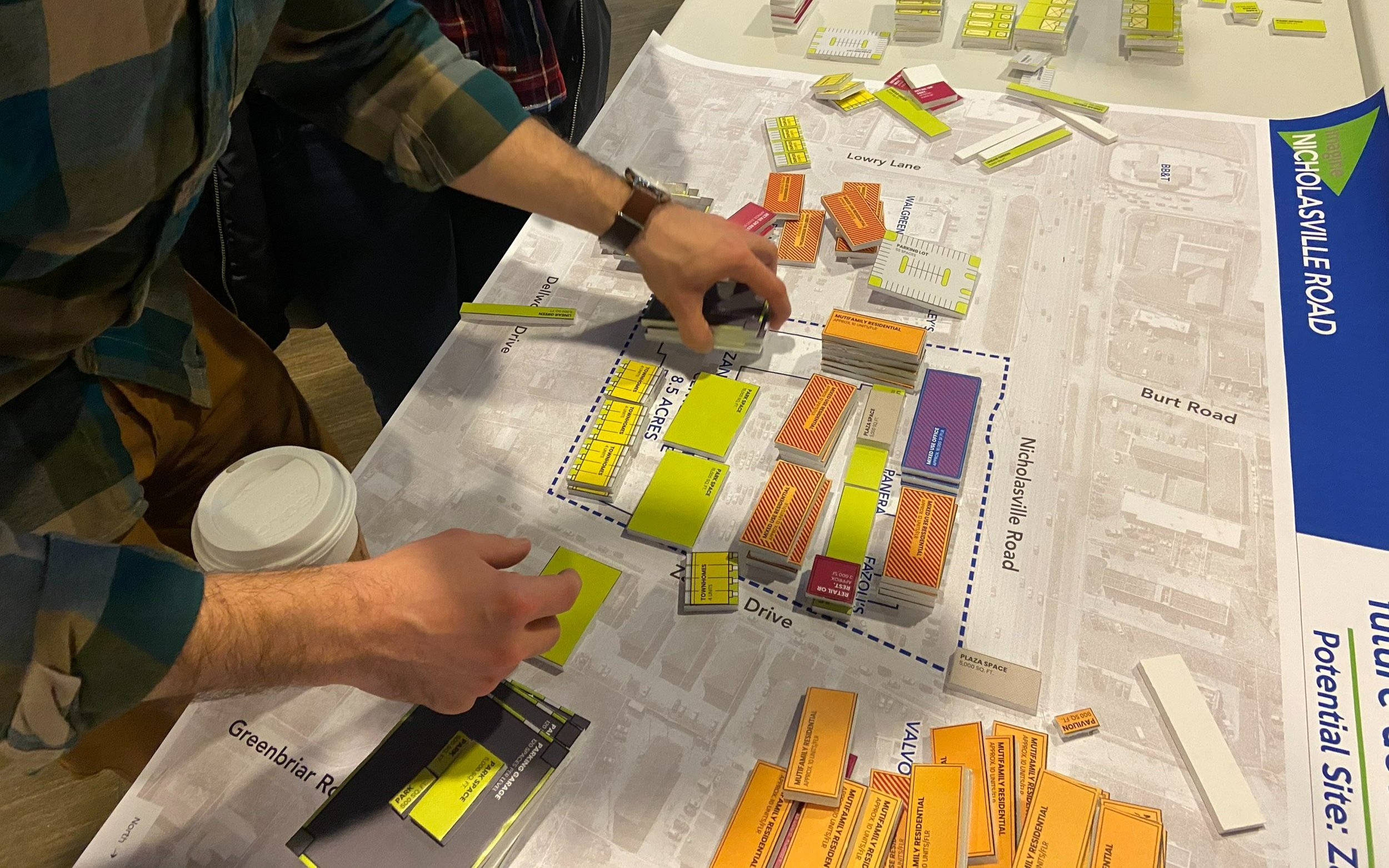
MKSK was part of a multi-disciplinary team that engaged the Lexington community to create a vision for Nicholasville Road, a major arterial that connects Downtown Lexington with neighboring Jessamine County. The study focused on creating a joint transportation and land use vision for the corridor that pairs Bus Rapid Transit (BRT) with Transit Oriented Development (TOD). The study reached a wide demographic of the Lexington community through a vigorous engagement process. This included two public meetings, one of which took place entirely online and attracted more than 3,000 total views. An online survey with more than 5,000 responses was used to understand existing conditions and gauge community support for development and transportation improvements.

The 26 sites were selected by the project team, following a baseline analysis that included examining current zoning, land use, and major users.
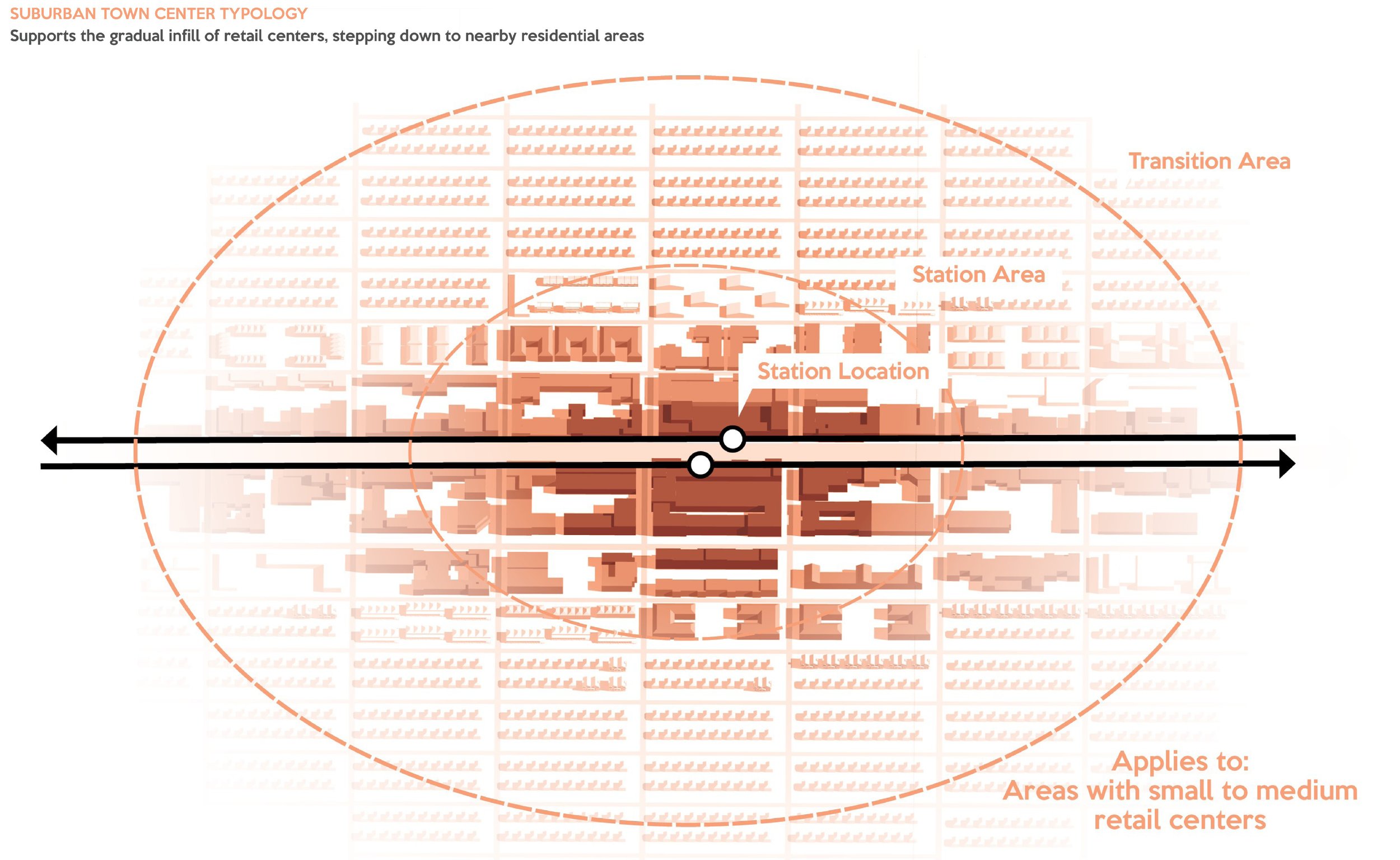
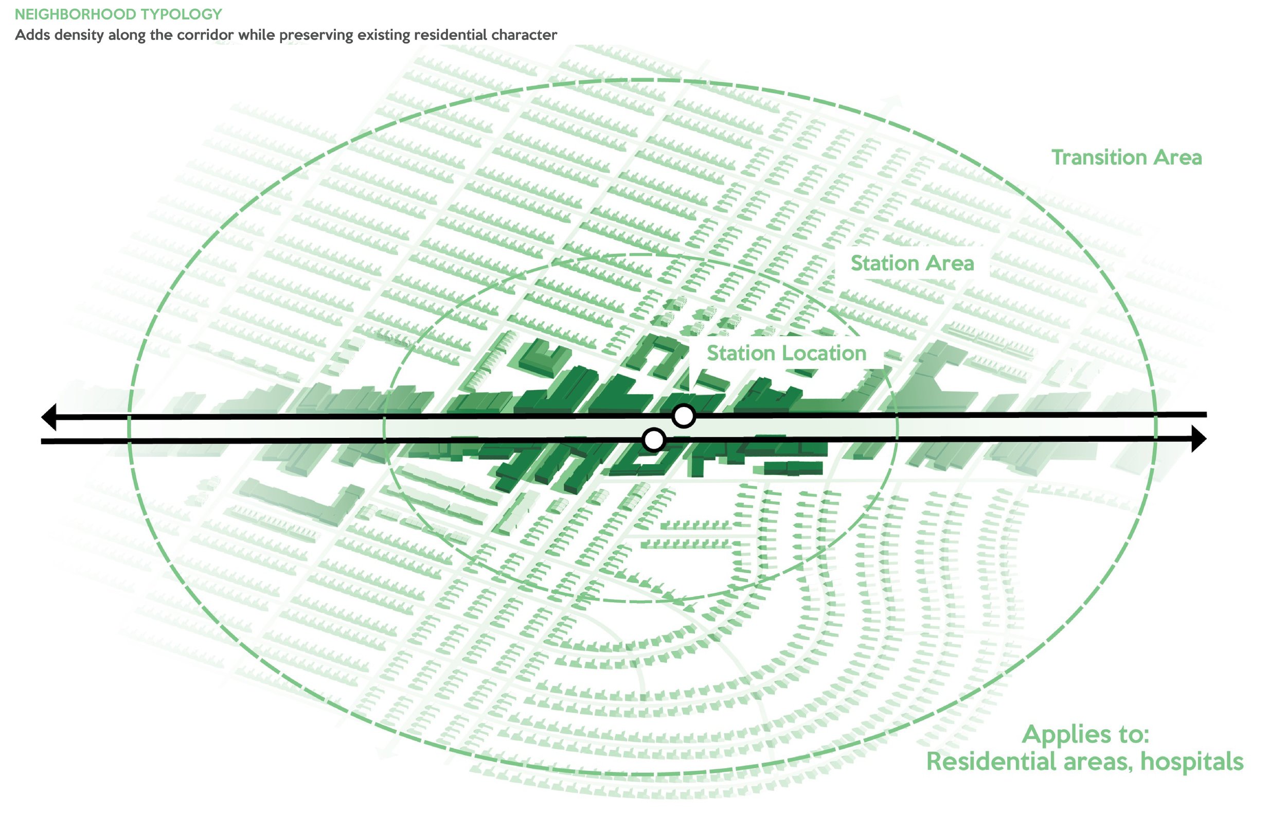
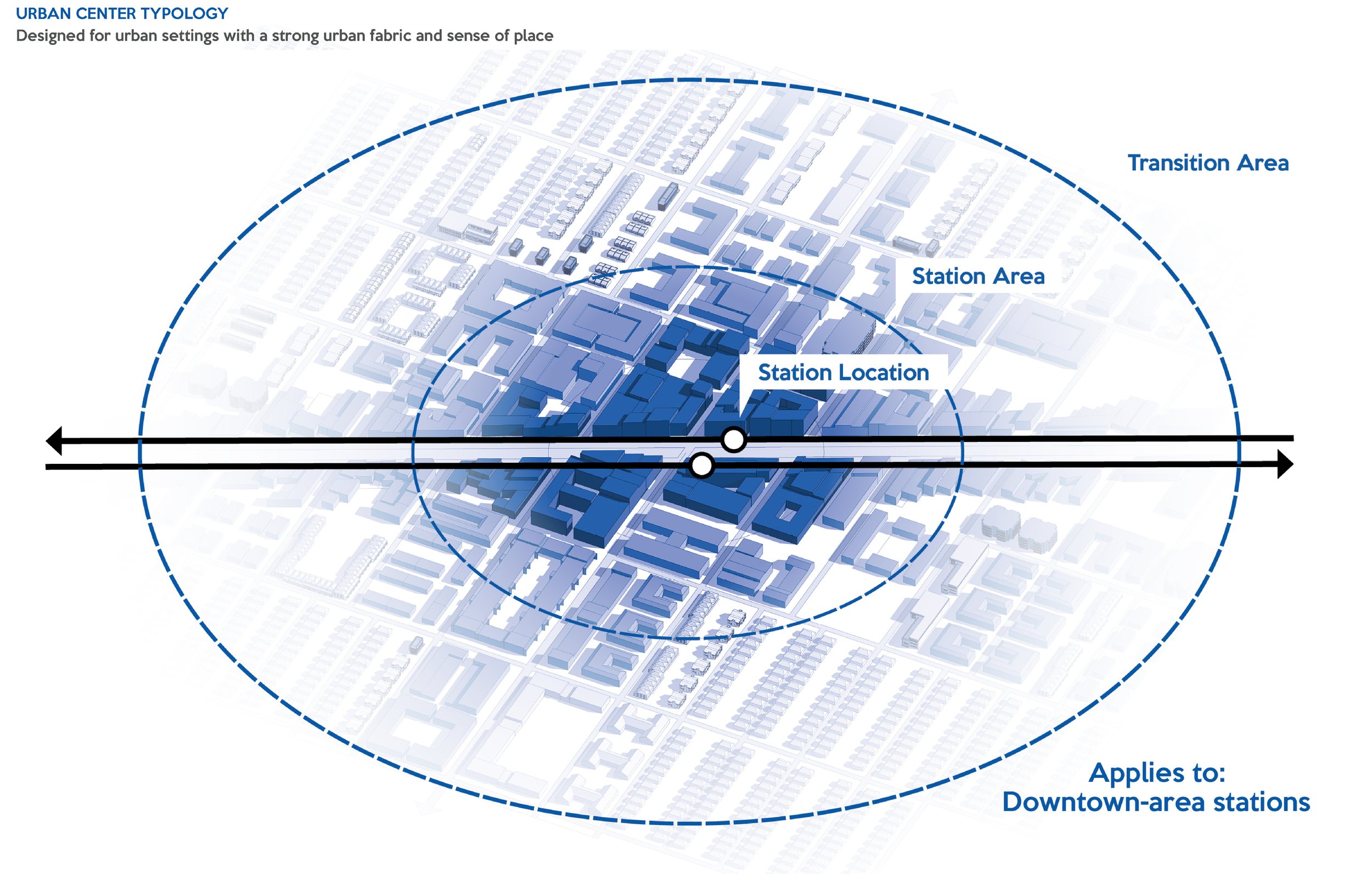
Four Development Typologies
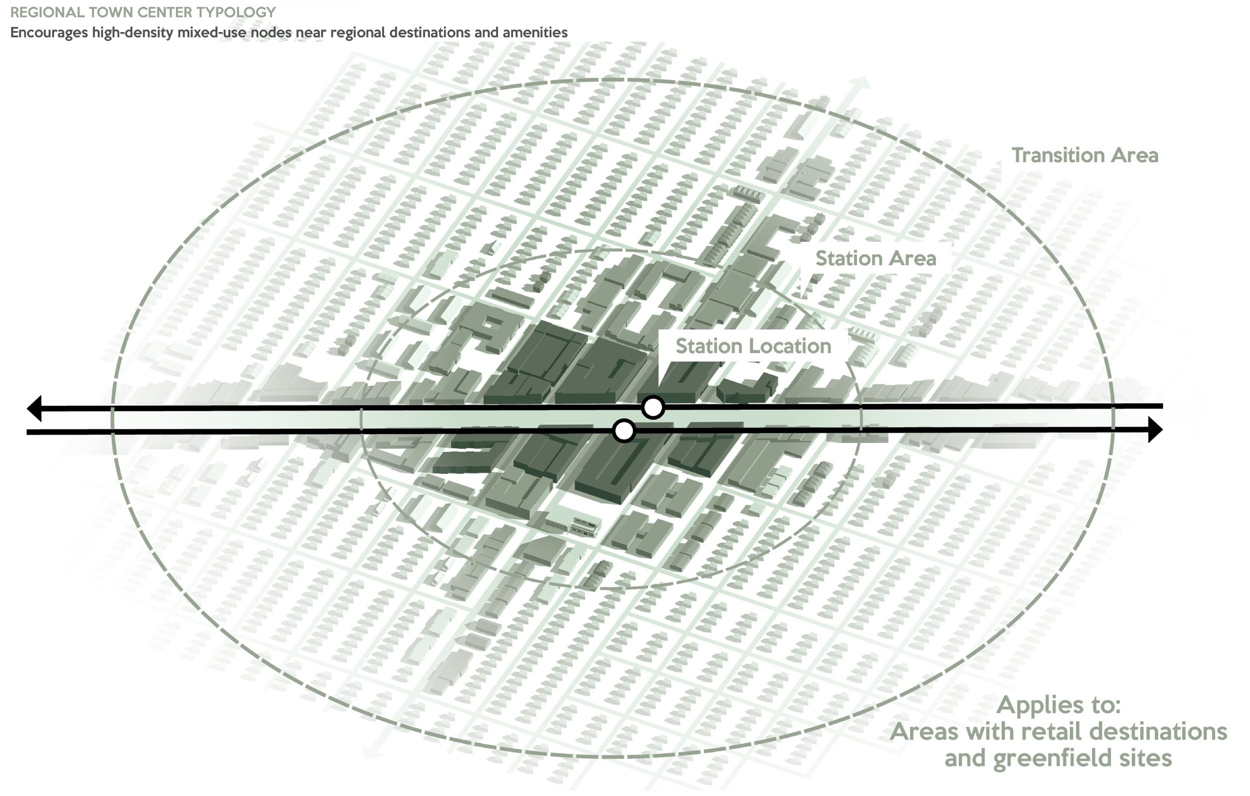
Each station is categorized as one of four development typologies identified in the graphic below, responding to the station’s surrounding character, land uses, and overall context.
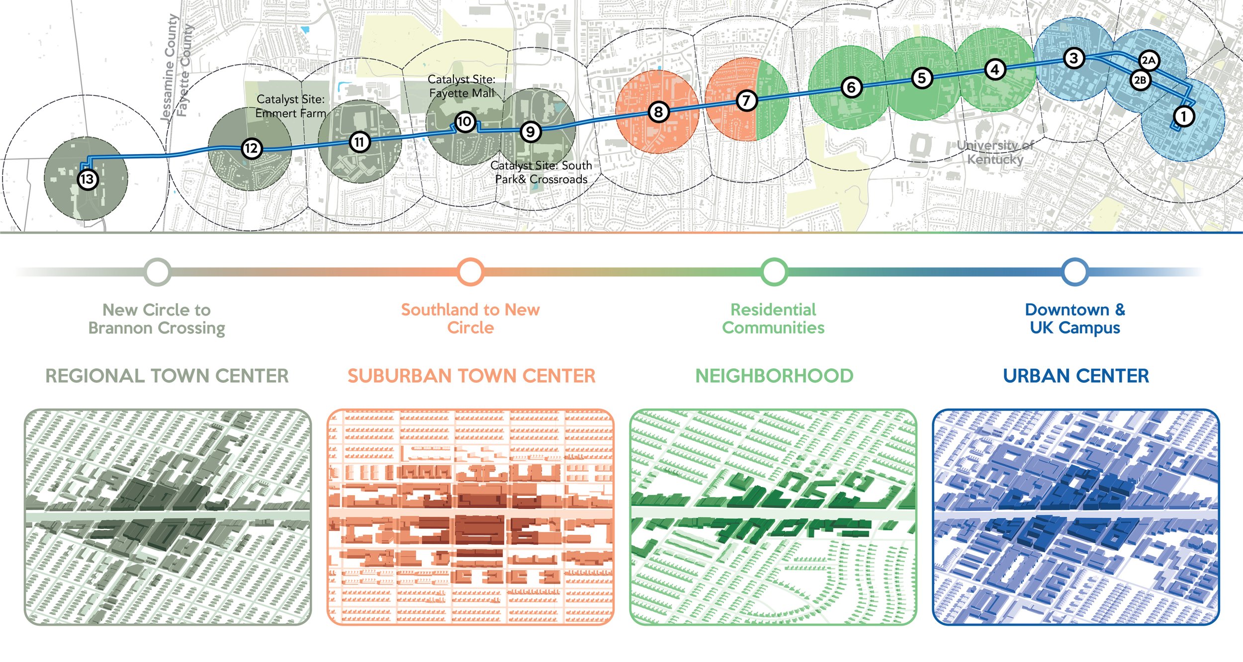
The Three Sites
The three sites selected for this study, shown in the accompanying map, are the South Park and Crossroads Shopping Centers, the Fayette Mall and The Plaza at Fayette Mall properties, and University of Kentucky’s Emmert Farm property at the corner of Man-O-War and Nicholasville Road. These three sites, all of which are located on Nicholasville Road south of New Circle Road, received among the highest scores in the selection criteria rankings, and were identified by members of the community as sites with opportunity for development.
The three sites, as exhibited by their respective results in the criteria, have advantageous traits that make TOD feasible. For instance, the sites are generally larger than 10 acres in size, have significant frontage along Nicholasville Road, and are controlled by less than five owners.